
Kuna ZIP Directory Coverage
Official Kuna-specific sources verify one current postal code: 83634. The Idaho Blue Book lists Kuna in Ada County with that ZIP, and the USPS location record identifies the Kuna Post Office. Nearby codes belong in the table only as comparison rows or historical clues. They should not be presented as current Kuna city codes without an official source.
| ZIP Code | Areas Covered | Post Office | Notes |
|---|---|---|---|
| 83634 | Kuna city mailing identity and Kuna-area addresses | Kuna Post Office | Only current ZIP verified in official Kuna-specific sources; postal reach may cross city limits |
| 83646 | Meridian-area ZIP with a historical Kuna delivery mismatch | USPS bulletin verification | 270 deliveries moved to 83634 in 2008; not verified as current Kuna ZIP |
| 83642 | Nearby Meridian service geography | Nearby USPS locations | Not verified as a current Kuna city ZIP |
| 83641 | Nearby Melba service geography | Nearby USPS locations | Not verified as serving Kuna city |
| 83709 / 83704 | Nearby Boise service areas | Nearby USPS locations | Not verified as Kuna city ZIPs |
No official Kuna ZIP-boundary GIS, PO-box-only code, unique-institution code, or neighborhood-by-ZIP crosswalk was found. The City community profile names Arbor Ridge, Butler, Crimson Point, Sadie Creek, and Winchester, but no official source assigns them separate postal codes. A clean Kuna ZIP code directory must preserve that limit rather than infer boundaries from nearby post offices.
The Idaho Blue Book provides state-government confirmation of the Kuna place and ZIP pairing.
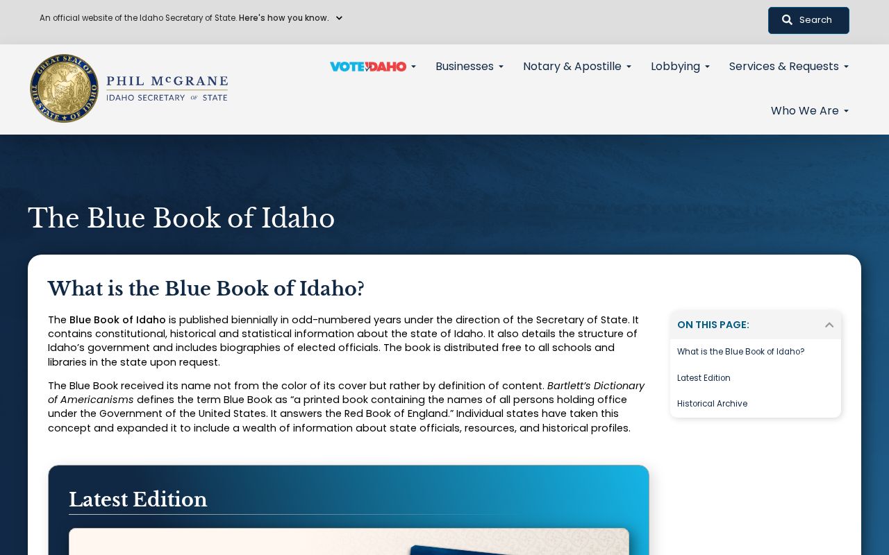
The capture supports 83634 as Kuna's verified current code, independent of the USPS station listing.
Kuna ZIP Code at USPS
The Kuna Post Office listing gives 693 E. Wythe Creek Court, Kuna, ID 83634-9998, and (208) 922-9888. That source confirms a postal facility and its service code. It does not confirm that a named person or business occupies an address, and it does not define Kuna's municipal line.
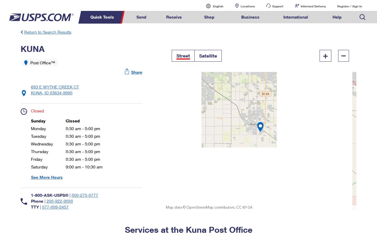
The USPS station capture is the direct channel for checking the post office details before relying on a third-party address label.
For an individual address, use the full street line rather than the city name alone. Apartment, suite, and unit data matter. If USPS returns more than one recognized city label, keep the postal answer separate from the city and parcel answers.
Search Kuna Postal Fields
The official USPS ZIP Code Lookup supports three distinct tasks. Address mode verifies a full mailing line. City and state mode returns codes for a postal place. ZIP mode works in reverse from a code. None is an open resident search.
| USPS mode | Required fields | Optional fields | Best Kuna use |
|---|---|---|---|
| Address | Street address, city, state | Company, apartment or suite, ZIP | Verify one complete mailing address |
| City and state | City, state | None documented | Confirm codes returned for Kuna |
| ZIP | ZIP | None documented | Check the postal place tied to a known code |
Results can contain multiple matches or pages. USPS warns that its result does not guarantee an actual business location or confirm a person or company at an address. Treat the result as postal evidence only.
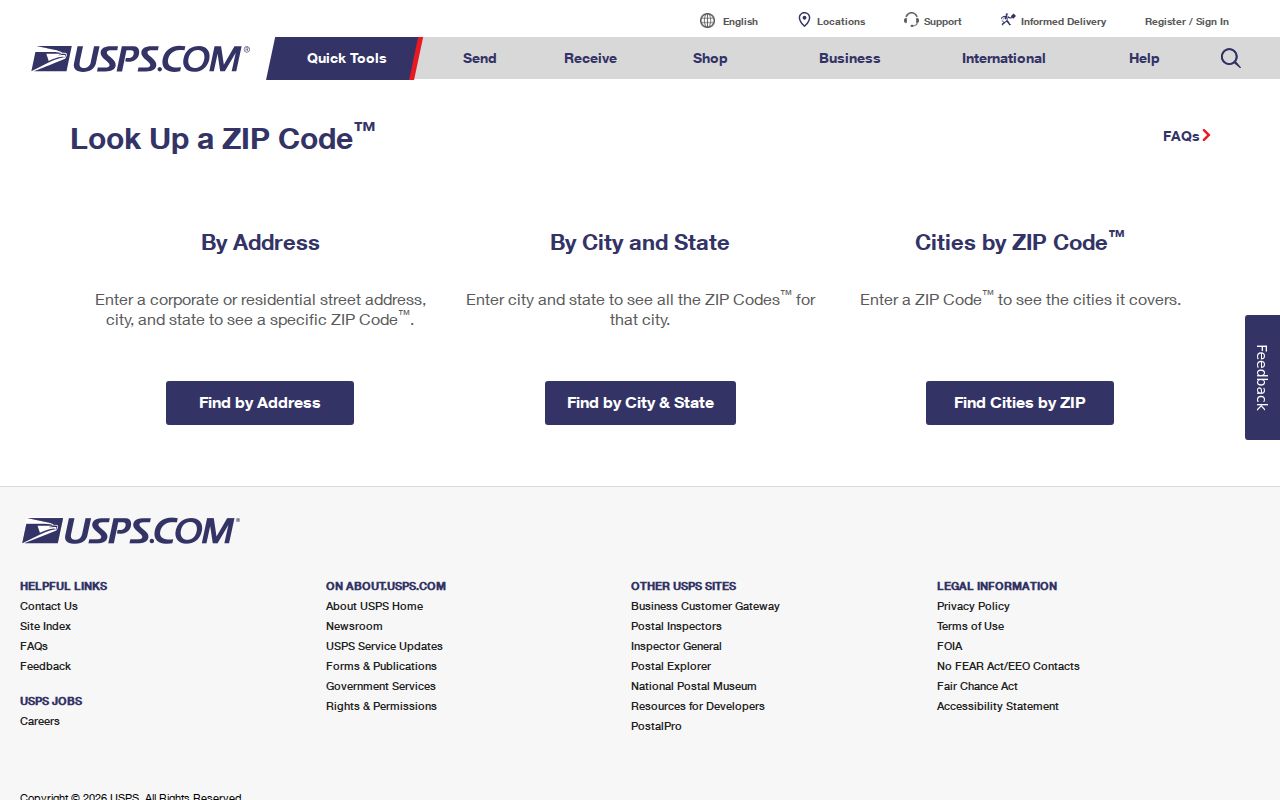
The lookup capture shows the correct official starting point for address, city-and-state, and code-based checks.
Use a Kuna ZIP in Records
No official Kuna-specific county portal in the research set supports a public ZIP-wide resident search. Ada County Property Lookup documents searches by address, parcel number, subdivision, and assessment year, not ZIP. The GIS data includes a city-and-state field but no documented ZIP control. VoteIdaho's self-check is for the voter, while the paid report form offers statewide, congressional-district, and legislative-district scopes rather than a public Kuna ZIP browser.
- Enter the complete street address in USPS Address mode and save the returned postal city, state, and code.
- Search Ada County Property Lookup by street address or parcel, then compare situs and mailing fields.
- Inspect the city-limit or Kuna GIS map as a separate test of municipal location.
- Keep parcel number and legal description with the result because they remain stronger land-record anchors than a postal label.
This sequence turns the ZIP code directory into a narrowing tool without claiming that a code reveals all occupants. Once a postal result narrows the place, the Kuna street directory explains the official street and parcel workflow.
Insider tip: record the postal city and assessor situs separately; matching words do not prove that the parcel falls inside Kuna's city line.
Kuna's 2008 ZIP Realignment
USPS Postal Bulletin 22241 records a precise local change. Effective September 6, 2008, 270 deliveries moved from 83646 to 83634. That is a useful historical test when an older address looks like Meridian but a newer record uses Kuna.
The realignment does not mean every 83646 address became Kuna, nor that 83646 is a current Kuna city ZIP. Search both codes for records around the change date, then anchor the land with its parcel number, legal description, and street. For family or address history, retain the old label rather than silently replacing it.
Did a code change move the property? No. A postal reassignment changes mail geography. It does not itself move a parcel, redraw the city limit, or alter the legal description.
Note: The verified bulletin count is 270 deliveries, not a count of residents, parcels, or households within Kuna.
Kuna ZIP Versus City Limits
A ZIP is designed for mail delivery, while a municipal boundary defines city jurisdiction. The two can overlap without matching. A Kuna mailing address may lie outside the formal city line, and an older record for land now read as Kuna may use Boise, Nampa, Meridian, or a rural route. The assessor's situs field states the property's physical address in the county system; the mailing field can point elsewhere.
- ZIP
- A five-digit USPS code used to route mail to a delivery area.
- ZIP+4
- The five-digit code plus four more digits that narrow a delivery segment, building, or group of boxes.
- PO-box ZIP
- A code used for post-office boxes. No Kuna-specific PO-box-only code was verified.
- Unique ZIP
- A code assigned to one high-volume organization. No Kuna unique code was found.
- Carrier route
- A group of addresses served along one postal delivery route, not a city or neighborhood boundary.
Compare four answers: USPS for the mailing label, Kuna GIS for the city boundary, the assessor for situs and mailing fields, and the recorder for the legal description. Each answers a different location question. A match in one does not erase a conflict in another.
Myth check: a Kuna ZIP, voter match, or assessed owner does not prove city-limit residence or identify every household member.
Historical Kuna Postal Labels
Modern 83634 should not be forced onto early sources. A Boise or Nampa regional directory, an Ada landowner list, a rural route, a census township, and today's Kuna mailing label can all point toward the same research subject at different dates. The date controls which label is useful.
For early property work, use the legal description, subdivision plat, township and section, or parcel lineage. For a person, pair the old postal place with a surname, occupation, newspaper date, and nearby address. Kuna's city archive begins in 1915, while Ada County records start far earlier. That difference is why county and regional labels matter.
Census estimates also show rapid recent growth, but population is not broken into a verified set of separate Kuna codes. The Census QuickFacts Kuna profile measures the city, not the USPS delivery area.
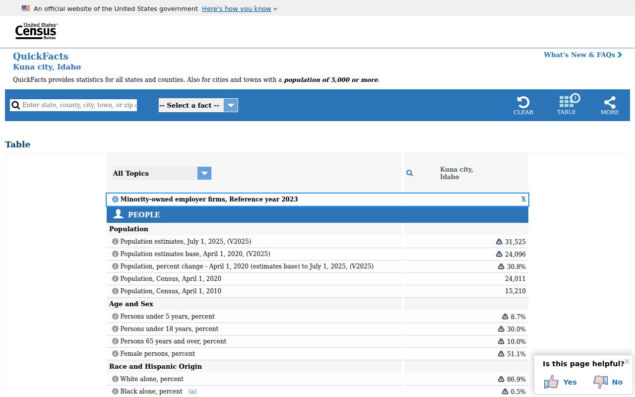
The Census capture helps distinguish a city statistic from a postal-area statistic, a key limit when comparing fast-growing Kuna records.
Kuna ZIP Lookup Fallbacks
When the online address result is unclear, use all documented channels. Contact the Kuna Post Office for postal questions, search the assessor by full address or parcel, check the city GIS maps, and ask the relevant custodian about an older address form. For a historic name, regional directories and newspapers may preserve the label used at the time.
The county assigns addresses in unincorporated areas, while Kuna retains a municipal addressing and planning role inside its jurisdiction. New subdivision addresses follow the recorded final plat, and public agencies receive new address information. No official source identified one citywide Kuna renumbering year, so do not assume every discrepancy came from a single project.
Ada County describes four address grids, each with a central zero point and numbers that grow outward. Lots are generally numbered in sequence, but an out-of-sequence number, private-road access, or an odd-and-even mismatch can require a change. Affected owners may appeal within 30 days under Ada County Code §2-1-11. That grid evidence can explain a street-number issue, yet it still does not turn a parcel boundary into a postal boundary. Compare the current situs address with the recorded plat and the USPS answer.
The official voter channels require the same care. VoteIdaho's public tool is an individual self-check, not an open browser of all Kuna residents in 83634. The Secretary of State's separate voter report form offers statewide, congressional-district, or legislative-district scope and requires a statutory acknowledgment. Its listed scope choices do not create a public ZIP-only search. When voter geography matters, keep the district result distinct from the postal code and follow Idaho's list-use restrictions.
Older address questions may need a nonportal channel. City map products, the county land-record counter, a written records request, library holdings, regional directories, and the state archives each preserve different dates and labels. Give staff the full street address, the code found, an approximate year, and any parcel or subdivision identifier. A precise request makes it easier to distinguish a postal reassignment from a plat change, annexation, or simple spelling variant.
A strong Kuna ZIP code directory result records both what is known and what remains open: postal code, city label, parcel identity, municipal status, source, and date checked. That record is far more useful than a bare five-digit match.